SUB-SAHARA INTERSTICE
Being the second largest Continent on earth, Africa faces many challenges, primarily, its infrastructure. In retrospect, Africa is a cluster of many villages with many cultures/tribes that are sporadically situated in many site conditions. Some villages larger than others due to trade and later becoming cities. However, with the advent of computing, environmentally safe materials, and advanced construction techniques for building; one is left to ask, the future of mud architecture, and where the next urban sprawl begins. Sub-Sahara interstice, is a prototype to generate a pragmatic and scalable village/urban condition.
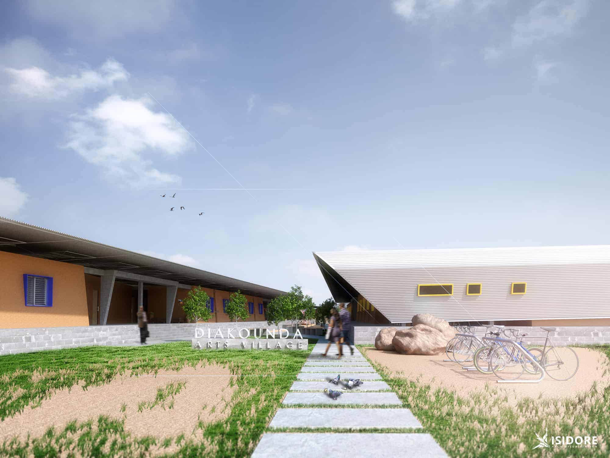
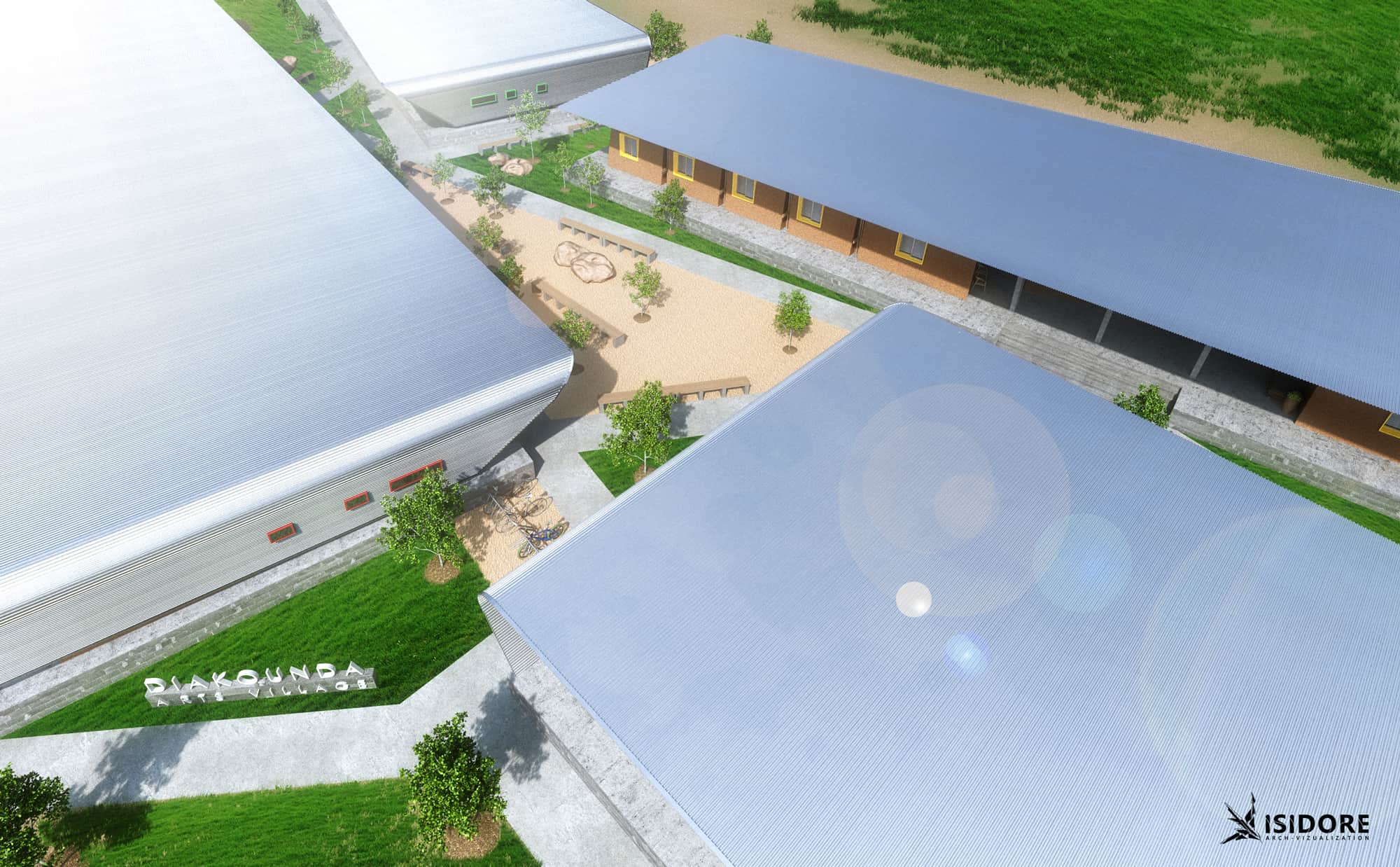
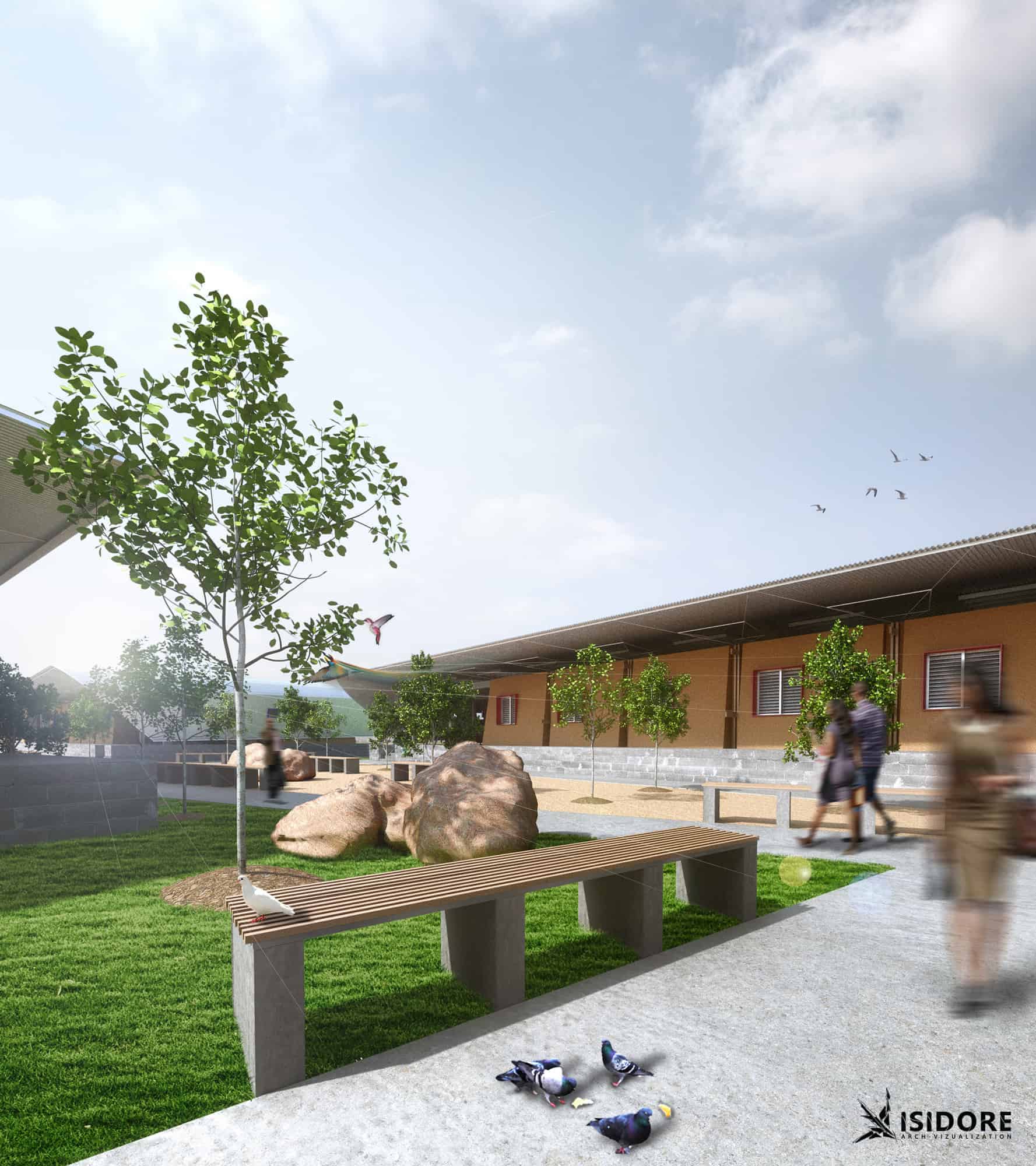
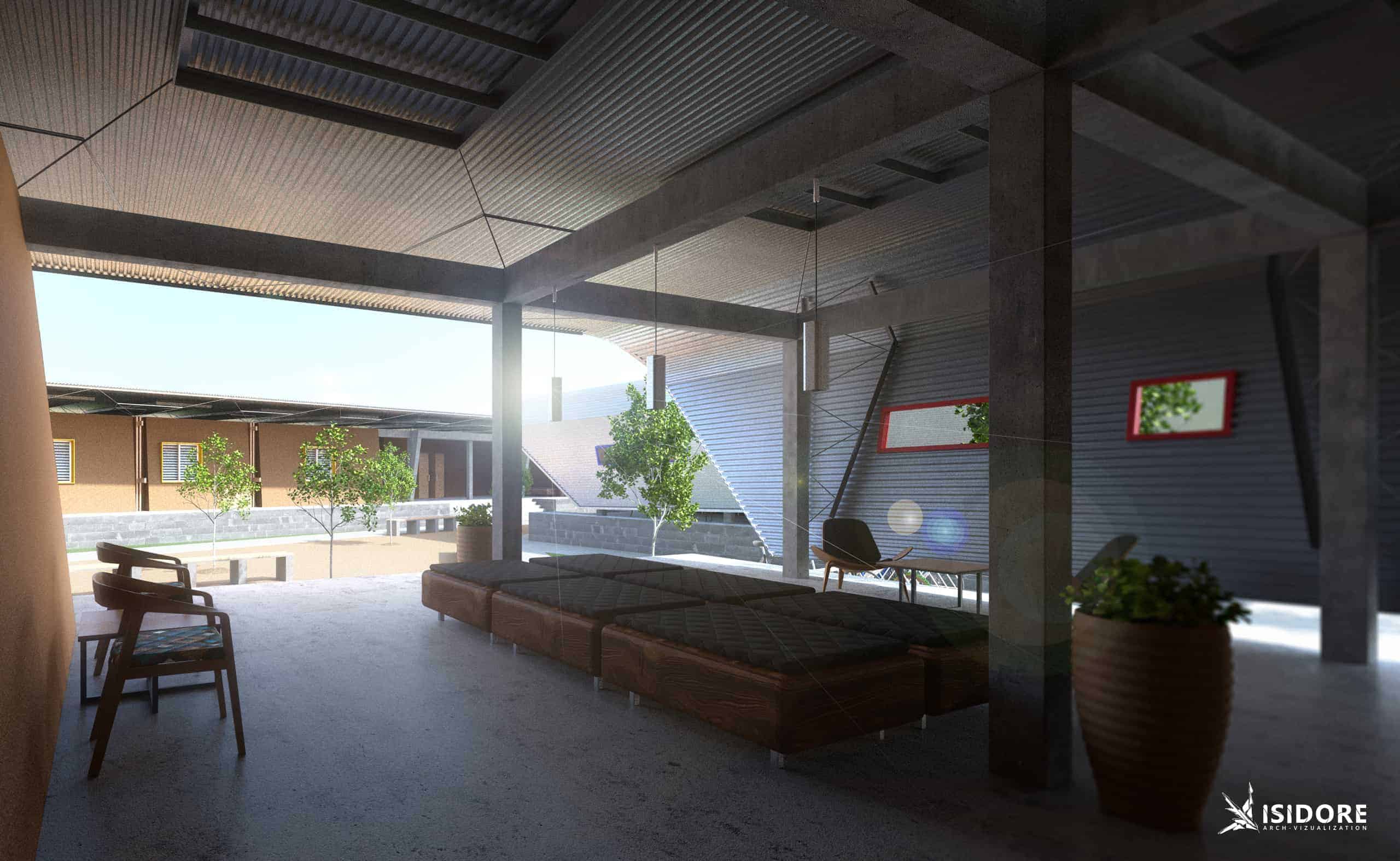
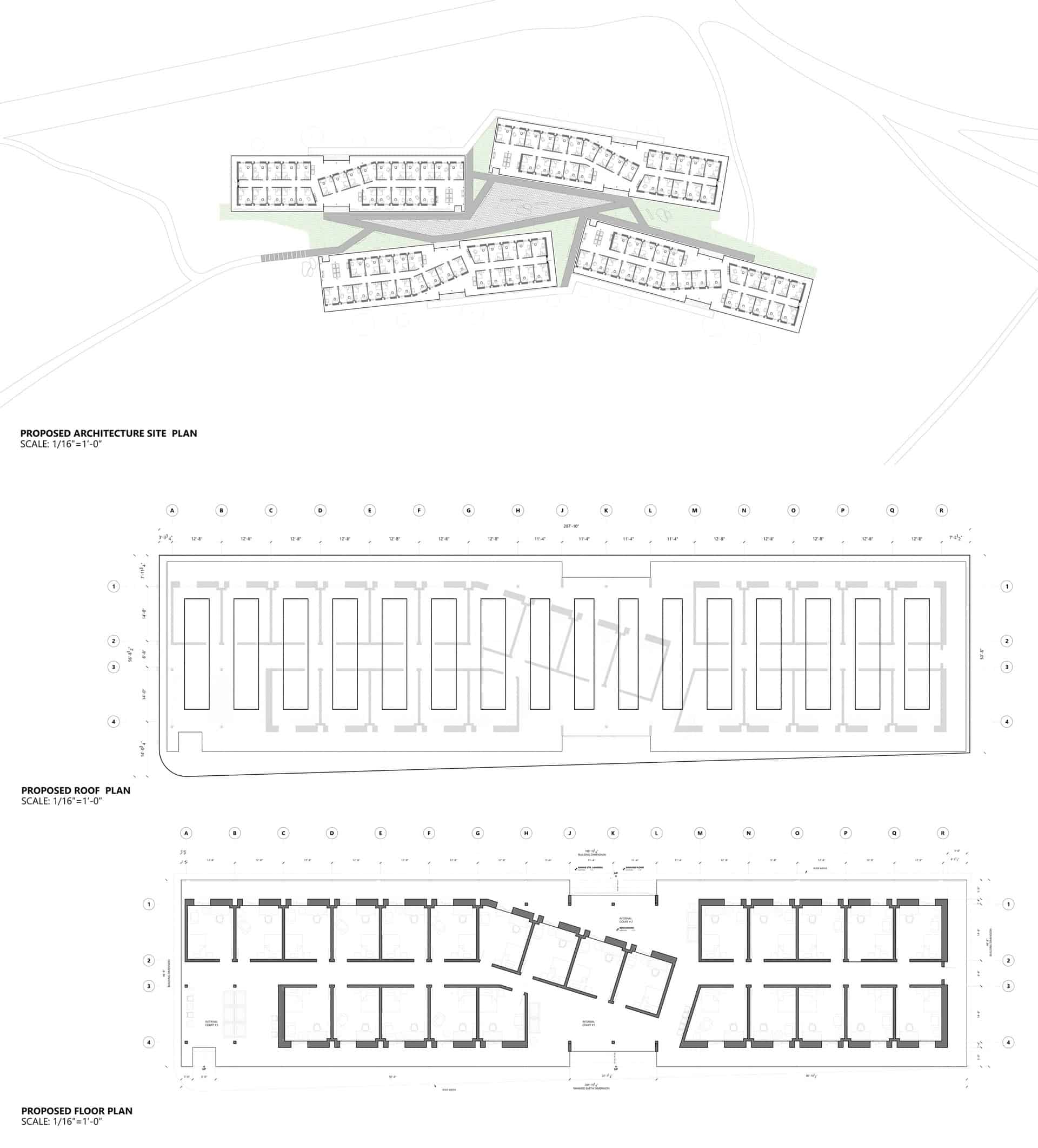
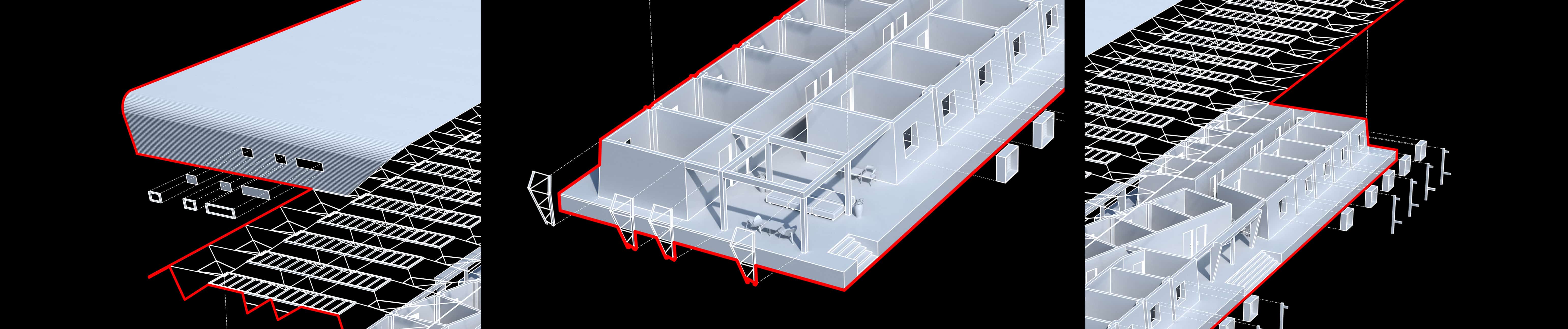
Conceived as a prototype to generate a pragmatic and scalable village/urban condition, the ideation of this proposal was developed through a careful study of the sun, solar heat gain, flow of rain precipitation, local source material (laterite), and courtyards. Taking these site conditions into account allowed me to generate an urban condition that is site specific. The first phase of the project was to orient the housing block in the trajectory of the sun reducing solar heat that affects the units. Furthermore, to create larger shade zones by extending the roof and redirect rain fall towards the shaded areas by sloping the roof. In doing so, additional courtyards are generated that are independent from the internal courtyards that are found in the housing modules in the first phase. It is here that the interstice occurs, in phase two, with outdoor space. This interstice, is a catalyst that generates many courtyards that are equidistant from the modular housing units. The expansion of this sprawl becomes the village, town, and city. Sub-Sahara Interstice is a site-specific condition, that generates an urban topology that is modular, scalable and responsive to the site.
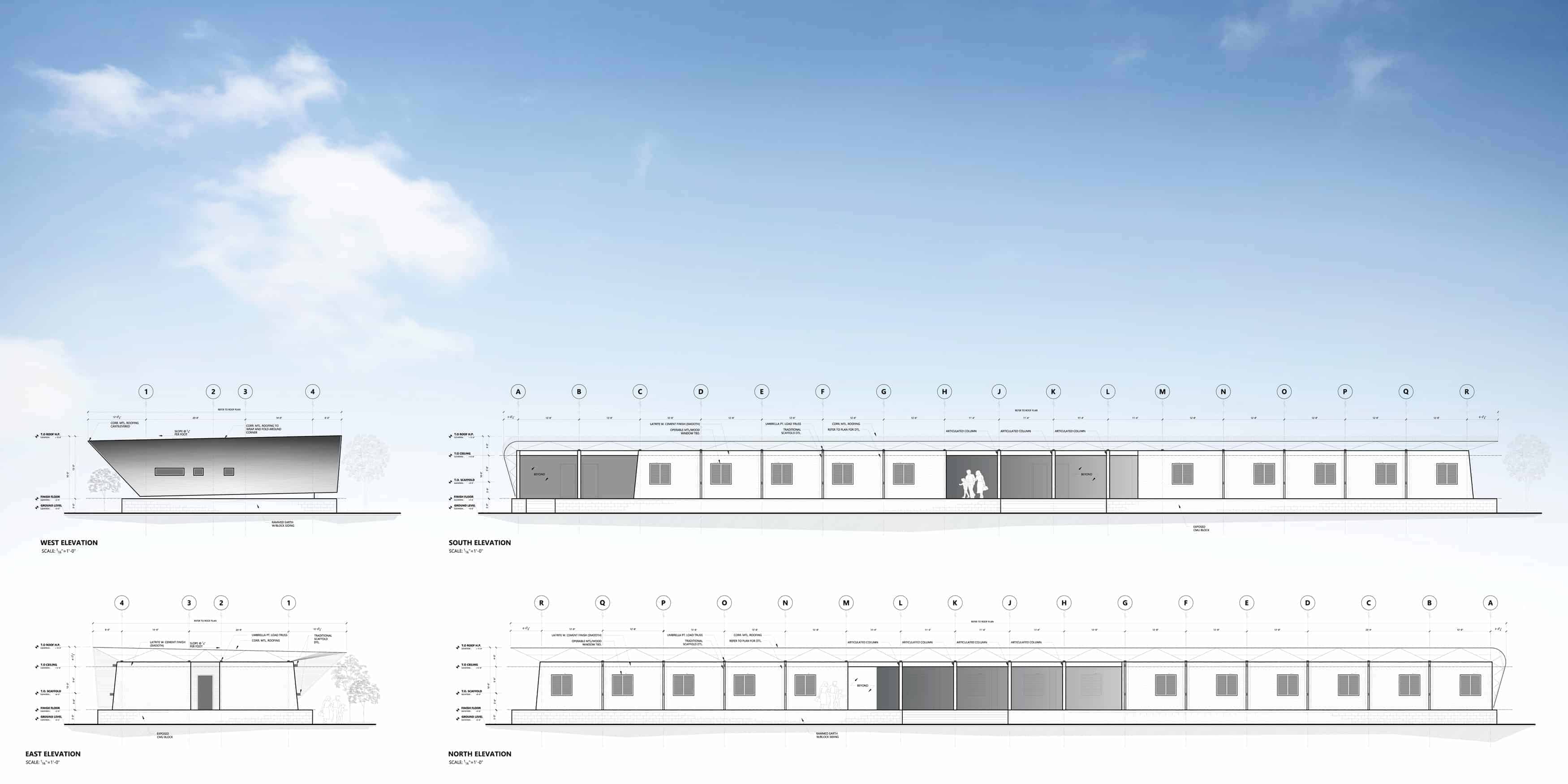
I find it is easy to manage my ideas digitally. As such, I use a Microsoft Surface Pro 4 to develop my concepts by using OneNote for sketching and organizing my ideas. Working in tandem with my surface pro, I use AutoCad Architecture to document my floor plans, elevations and sections. Then, to ensure that the project is easily understandable by the layman, I use Rhino to construct the architecture and 3ds Max to develop the site because of contours. When finished with the model, for this proposal I used Maxwell render 3.0 to render; then use photoshop for post-processing. For this project I chose to render 10 images that best curates this urban condition. Supported images are demonstrated in this post.
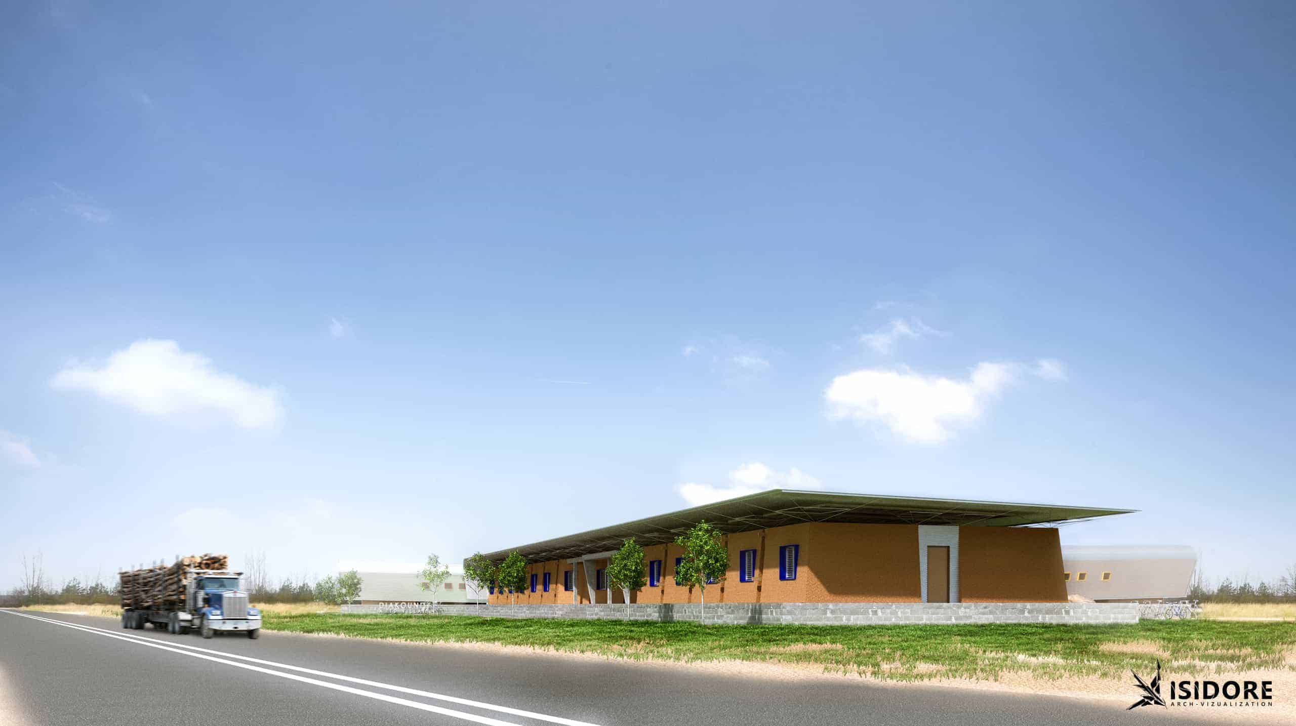
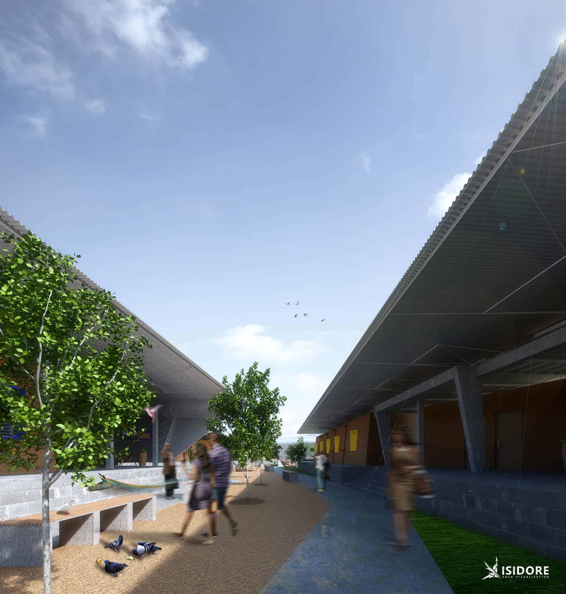
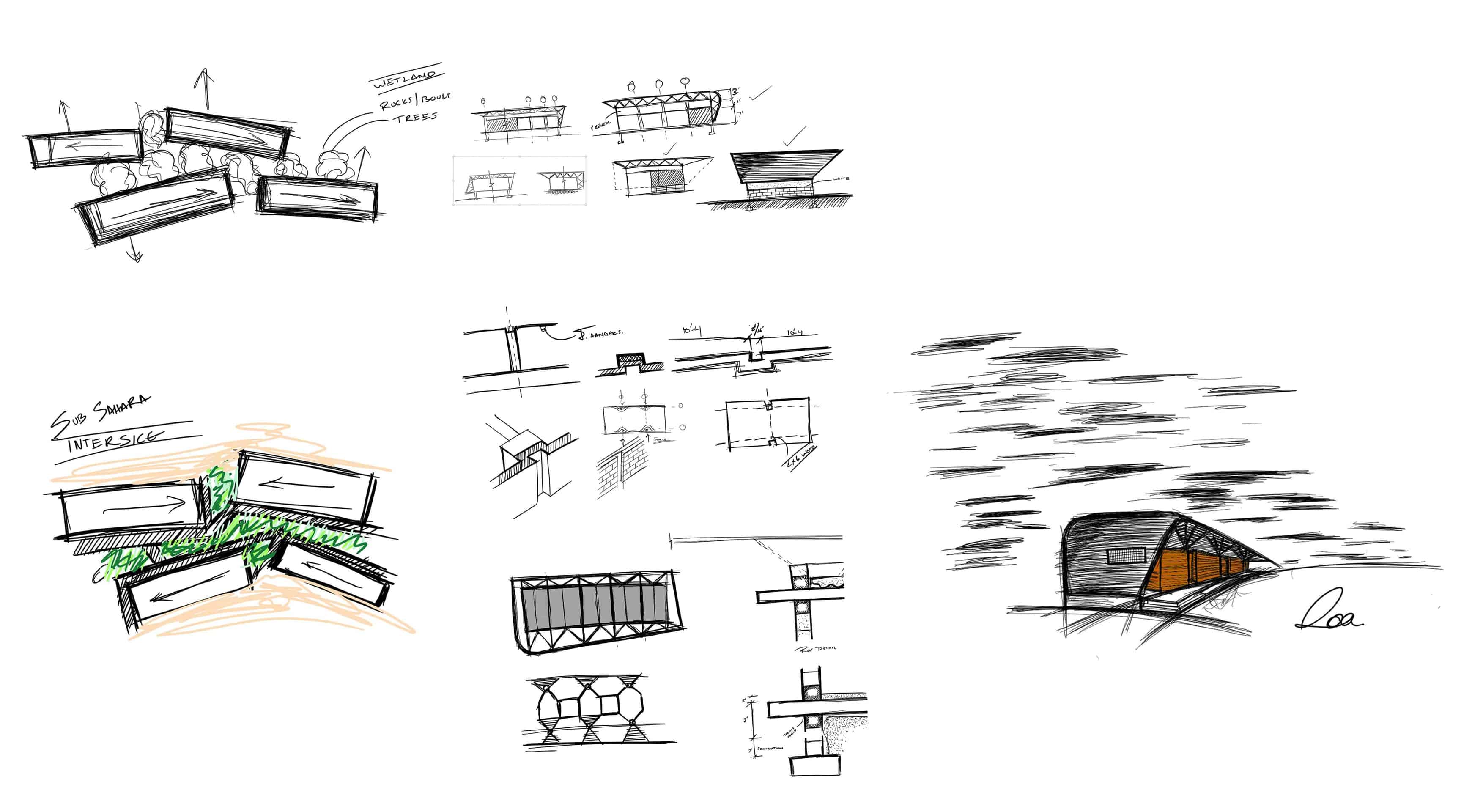
The initial reaction is wow! That’s a pretty nice shaded area or Can the roof Extend and wrap around the building like that or that’s a neat mud building when describing the architecture. These are the kind of questions and remarks I had hoped to receive when designing this proposal for the NKA ARTS Competition. This is because, at the core of this urban condition are a series of interconnected programs, materials and site conditions. These being, the orientation of each massing block in relation to the trajectory of the sun, solar heat gain, flow of rain precipitation, local source material (laterite), and courtyards.
“AN IDEA? LET US EXPLORE IT, TEST IT, IMAGINE IT; TILL, WE DESIGN THE IMPOSSIBLE.”